Wolfram Data Repository
Immediate Computable Access to Curated Contributed Data
NYC Emergency Response Incidents from 2013 to 2015
Originator: City of New York
Type and location of emergency incidents to which Office of Emergency Management (OEM) responded
(5 columns, 2524 rows)
View a sample of the data:
| In[1]:= |
| Out[1]= |  |
Generate a map of requests near Central Park:
| In[2]:= | ![GeoListPlot[ResourceData[\!\(\*
TagBox["\"\<NYC Emergency Response Incidents\>\"",
#& ,
BoxID -> "ResourceTag-NYC Emergency Response Incidents-Input",
AutoDelete->True]\)][All, "Coordinates"], GeoRange -> Quantity[1, "Miles"], GeoCenter -> Entity["Park", "CentralParkNYC"]]](https://www.wolframcloud.com/obj/resourcesystem/images/05b/05b32d96-0fb8-4d55-af85-0dad5a7696af/4e1cf20919f13753.png) |
| Out[2]= | 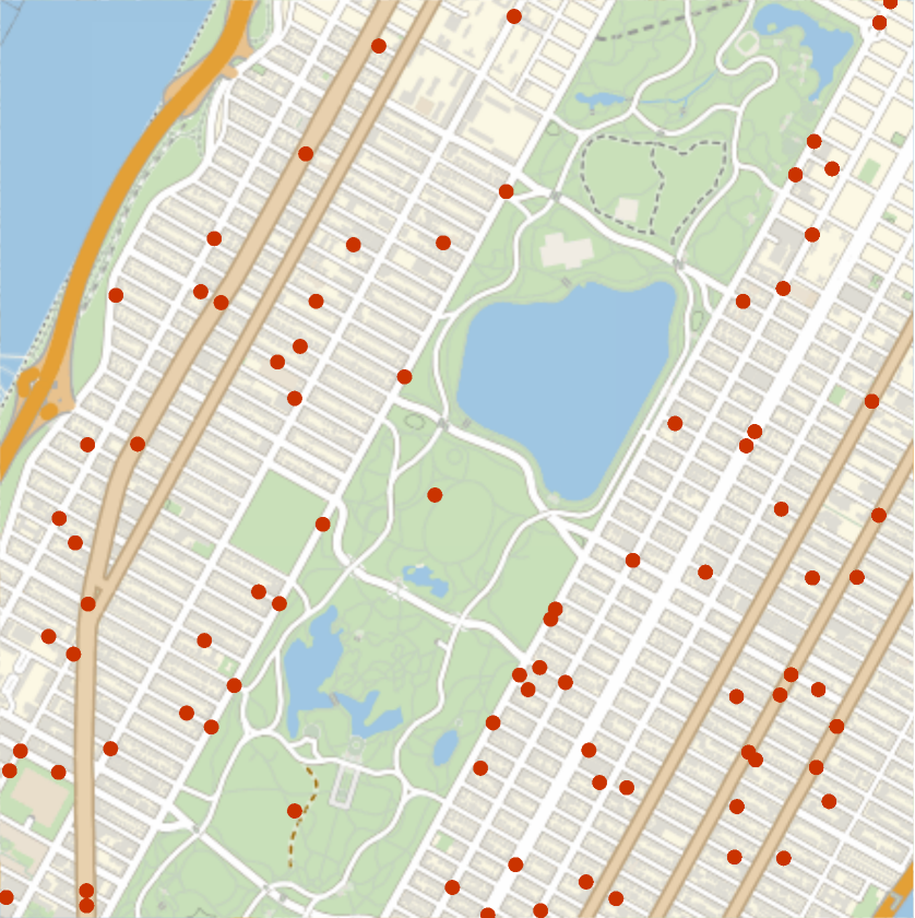 |
Tally and visualize incidents by Borough:
| In[3]:= | ![Column[{boroughcounts = Tally[ResourceData[\!\(\*
TagBox["\"\<NYC Emergency Response Incidents\>\"",
#& ,
BoxID -> "ResourceTag-NYC Emergency Response Incidents-Input",
AutoDelete->True]\)][Select[Head[#Borough] == Entity &]][All, 4]], GeoRegionValuePlot[boroughcounts]}]](https://www.wolframcloud.com/obj/resourcesystem/images/05b/05b32d96-0fb8-4d55-af85-0dad5a7696af/401171de79367329.png) |
| Out[3]= | 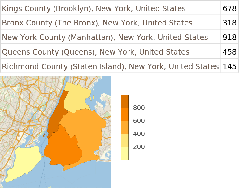 |
Wolfram Research, "NYC Emergency Response Incidents" from the Wolfram Data Repository (2016) https://doi.org/10.24097/wolfram.37814.data
Anyone can use these data sets to participate in and improve government by conducting research and analysis or creating applications. By accessing data sets and feeds available through the NYC OpenData portal, the user agrees to all of the Terms of Use of NYC.gov as well as the Privacy Policy for NYC.gov.