Wolfram Data Repository
Immediate Computable Access to Curated Contributed Data
Dataset of seasonal and long-term groundwater level measurements in groundwater basins in California
Originator: California Department of Water Resources
The DWR Periodic Groundwater Levels dataset contains seasonal and long-term groundwater level measurements collected by the Department of Water Resources and cooperating agencies in groundwater basins statewide. It also includes data collected through the CASGEM (California Statewide Groundwater Elevation Monitoring) Program. Most measurements are taken manually twice per year to capture the peak high and low values in groundwater elevations. However, the dataset also includes measurements recorded more frequently, monthly, weekly, or daily. For groundwater level measurements recorded at more frequent intervals, please refer to DWR's "Continuous Groundwater Level Measurements" dataset.
Retrieve the resource:
| In[1]:= |
| Out[1]= |  |
Retrieve the default content:
| In[2]:= |
| Out[2]= | 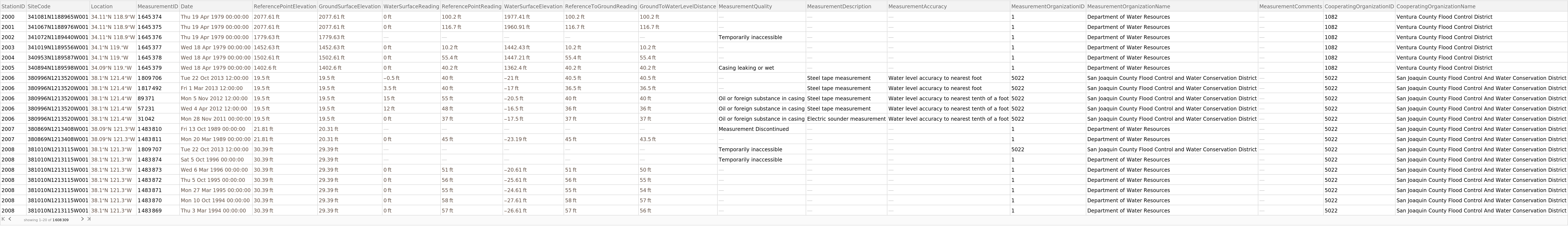 |
Retrieve a different content element:
| In[3]:= |
| Out[3]= |
| In[4]:= |
| Out[4]= | 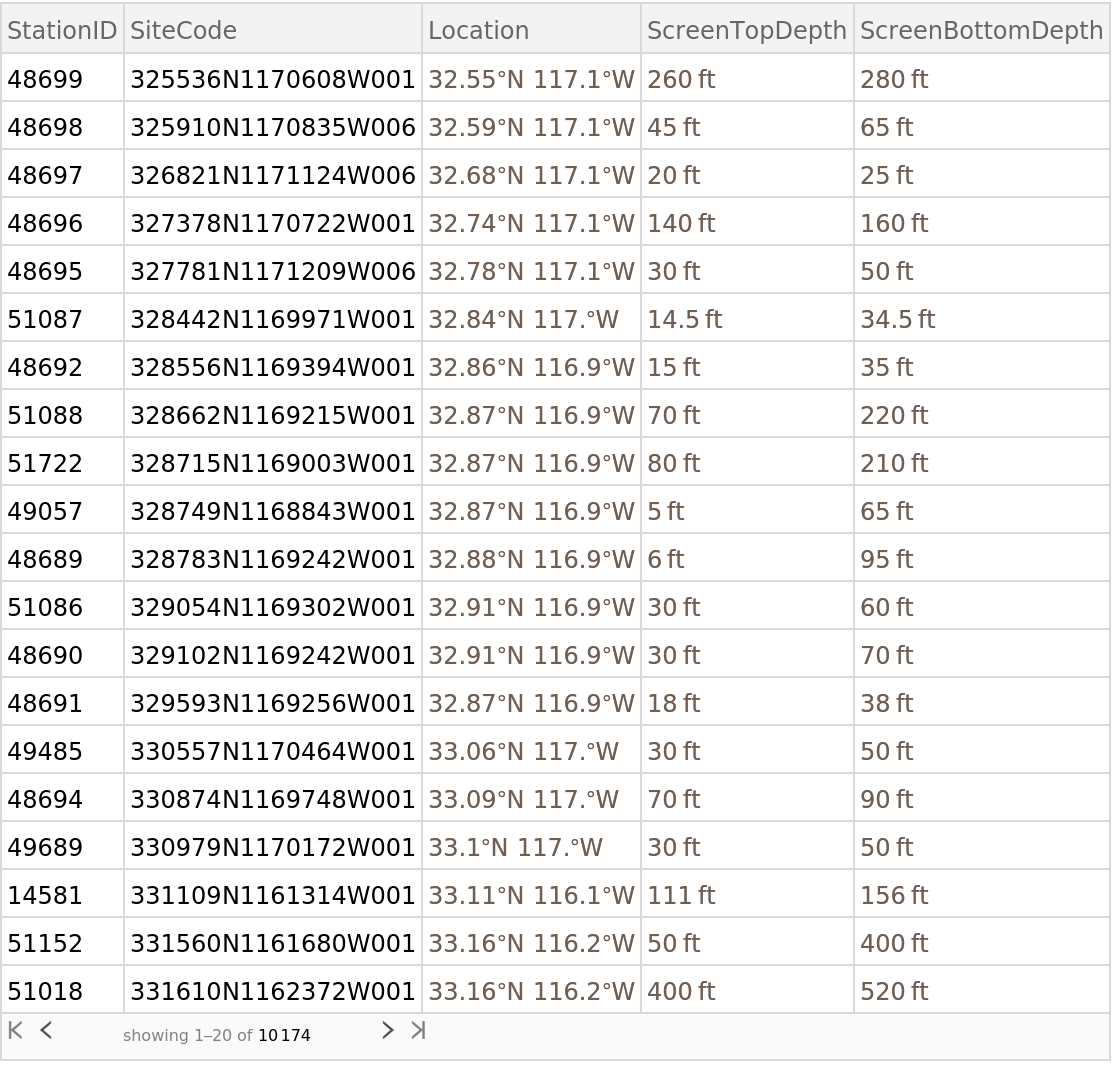 |
Create a GeoHistogram of well sites in San Diego County:
| In[5]:= | ![GeoHistogram[
Select[ResourceData["Periodic Groundwater Level Measurements", "Stations"], #County == Entity["AdministrativeDivision", {"SanDiegoCounty", "California",
"UnitedStates"}] &][All, #Location &]]](https://www.wolframcloud.com/obj/resourcesystem/images/4e8/4e87098a-14e2-4c52-8817-836ead042a30/276b2e336f0c3ec4.png) |
| Out[5]= | 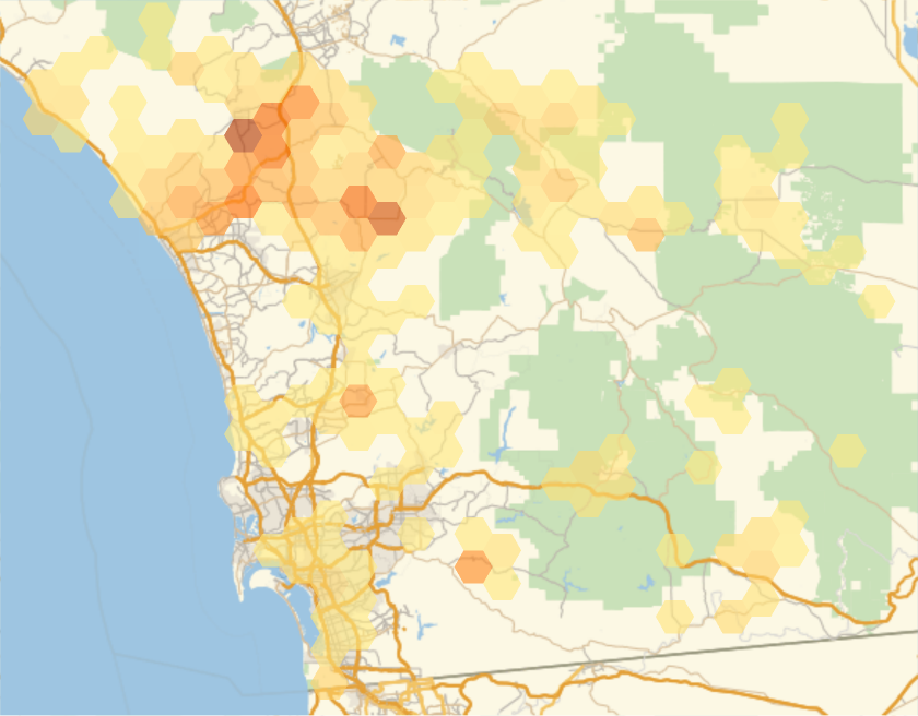 |
Wolfram Research, "Periodic Groundwater Level Measurements" from the Wolfram Data Repository (2018)