Wolfram Data Repository
Immediate Computable Access to Curated Contributed Data
Dataset of agricultural land use and irrigated acres in California
Originator: California Department of Water Resources
This is the official dataset of CADWR for determining agricultural land use and irrigated acres in 2014. The purpose is provide information for resource planning and assessments across multiple agencies. DWR manages California's water resources, systems, and infrastructure, including the State Water Project (SWP), in a responsible, sustainable way.
Retrieve the resource:
| In[1]:= |
| Out[1]= |  |
Retrieve the default content:
| In[2]:= |
| Out[2]= | 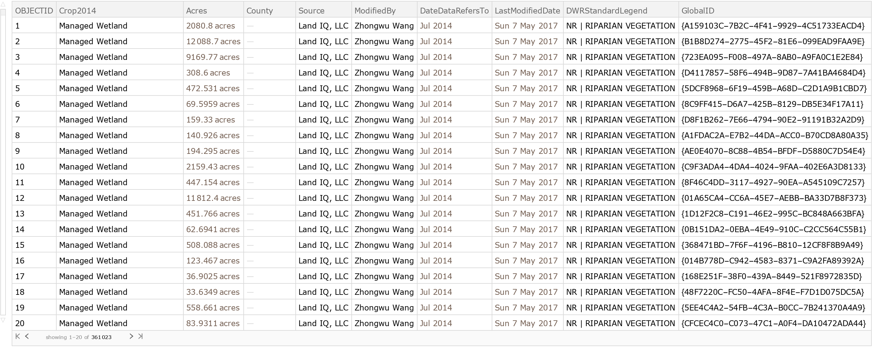 |
Identify the land uses occupying the greatest acreage:
| In[3]:= |
| Out[3]= | 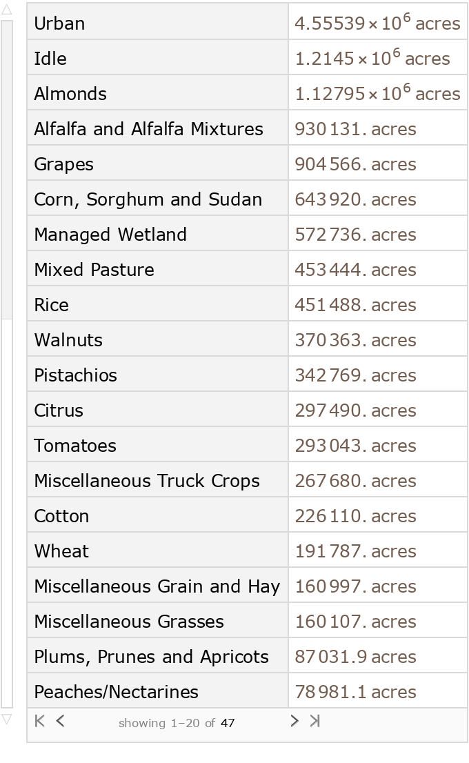 |
Plot the counties with the greatest number of agricultural acres:
| In[4]:= |
| Out[4]= | 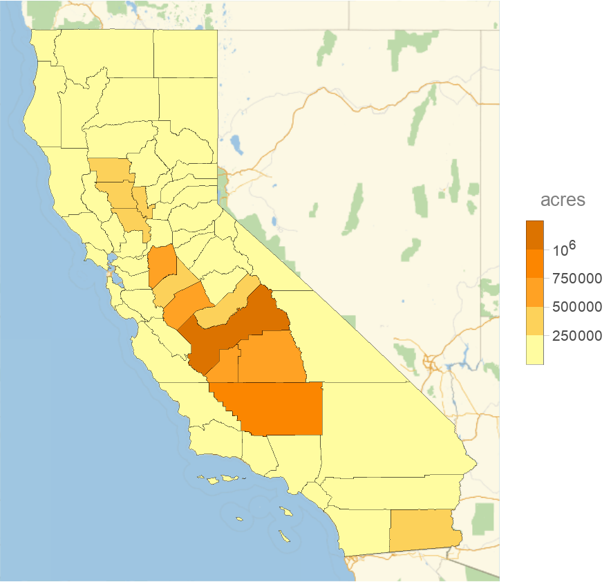 |
Wolfram Research, "California Crop Mapping" from the Wolfram Data Repository (2018)