Wolfram Data Repository
Immediate Computable Access to Curated Contributed Data
The USDA's comprehensive report on food accessibility in America
Originator: U.S. Department of Agriculture
This dataset contains information on food accessibility for Americans in each census tract as taken from the 2010 U.S. Census. It includes information on the rates of low access to food among low-income individuals, children, and seniors, and also those households who do not have vehicle access. Such figures are compared to the population of each tract. Each variable is repeated to distinguish those at a half mile, 1 mile, 10 miles, and 20 miles away from a supermarket with different figures.
(64 columns, 72864 rows)
Retrieve the ResourceObject:
| In[1]:= |
| Out[1]= |  |
View the data:
| In[2]:= |
| Out[2]= |  |
Generate a heat map of US counties by number of census tracts located more than 10 miles from a supermarket:
| In[3]:= | ![GeoRegionValuePlot[
Length /@ GroupBy[ResourceData["Food Access Research Atlas"][
Select[#LATracts10 == True &]], "County"], GeoRange -> EntityClass["AdministrativeDivision", "ContinentalUSStates"]]](https://www.wolframcloud.com/obj/resourcesystem/images/6d2/6d2d1ccb-3b2a-4c85-9973-e022f5253775/1b631a84117e3ed6.png) |
| Out[3]= | 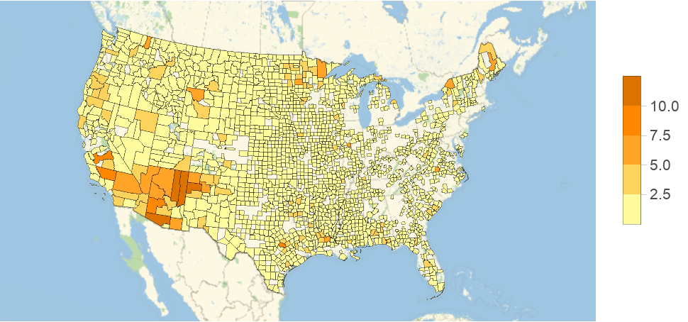 |
Wolfram Research, "Food Access Research Atlas" from the Wolfram Data Repository (2016) https://doi.org/10.24097/wolfram.06651.data
Public Domain