Wolfram Data Repository
Immediate Computable Access to Curated Contributed Data
Geographical descriptions and locations of Indian Reservations throughout the U.S.
Originator: Homeland Infrastructure Foundation-Level Data
(11 columns, 827 rows)
Retrieve the ResourceObject:
| In[1]:= |
| Out[1]= |  |
View the data:
| In[2]:= |
| Out[2]= | 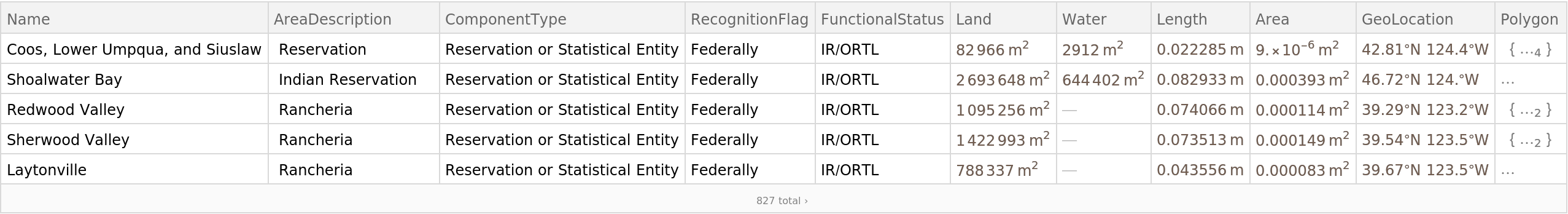 |
Plot the locations of Indian Reservations in Arizona:
| In[3]:= | ![GeoListPlot[ResourceData["Indian Reservations"][All, "GeoLocation"], GeoRange -> Entity["AdministrativeDivision", {"Arizona", "UnitedStates"}]]](https://www.wolframcloud.com/obj/resourcesystem/images/8f3/8f3f501f-f929-4673-8fb5-d69c82026b69/146d4d9135a9abdc.png) |
| Out[3]= | 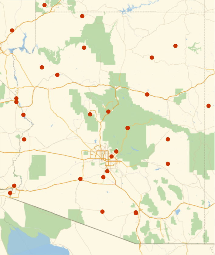 |
Wolfram Research, "Indian Reservations" from the Wolfram Data Repository (2017) https://doi.org/10.24097/wolfram.25051.data