Wolfram Data Repository
Immediate Computable Access to Curated Contributed Data
A comprehensive list of all retailers accepting SNAP payments in the U.S.
Originator: U.S. Department of Agriculture
This dataset contains locational information on every SNAP retailer in the United States as of 2014. For each retailer, the dataset links up to Wolfram entities for the city, county, ZIP code, and state that the retailer is located in, along with providing coordinates.
(9 columns, 261870 rows)
Retrieve the ResourceObject:
| In[1]:= |
| Out[1]= |  |
View the data:
| In[2]:= |
| Out[2]= | 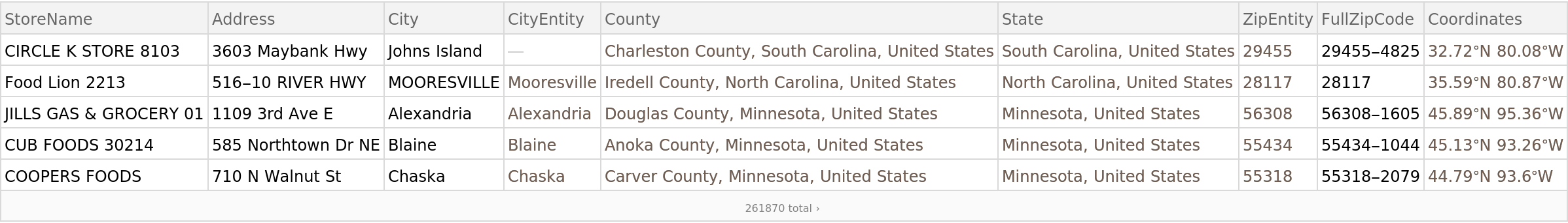 |
Find the closest retailers in your city:
| In[3]:= | ![closest = Select[ResourceData[
"SNAP Retailers"], #["CityEntity"] == Entity["City", {"Champaign", "Illinois", "UnitedStates"}] &][
TakeSmallestBy[GeoDistance[#Coordinates, Here] &, 5]]](https://www.wolframcloud.com/obj/resourcesystem/images/98b/98b7f761-7bd3-4a15-8ed9-f4ac3a846bec/3f7f89e941228536.png) |
| Out[3]= | 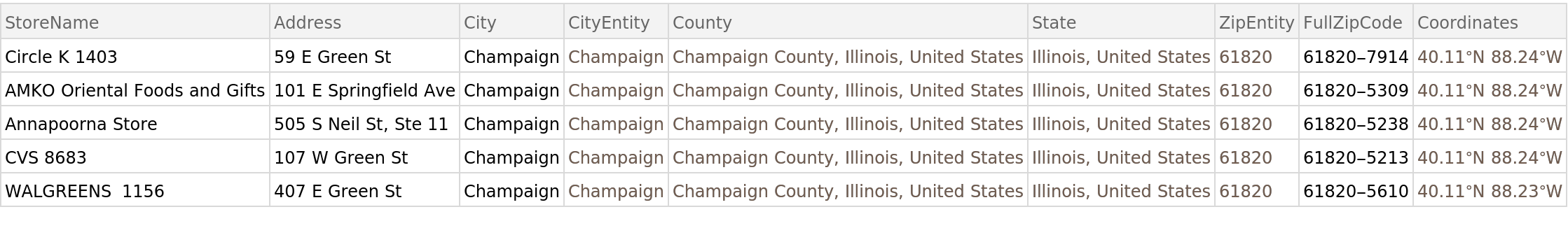 |
Show them on a map:
| In[4]:= |
| Out[4]= | 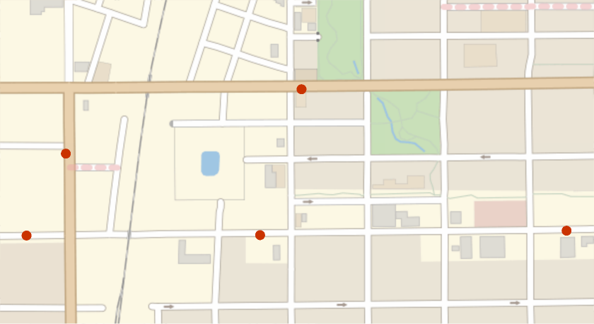 |
Find the states with the most retailers:
| In[5]:= |
| Out[5]= | 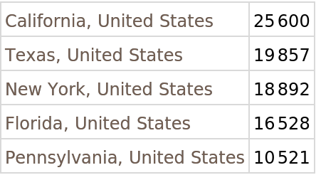 |
Wolfram Research, "SNAP Retailers" from the Wolfram Data Repository (2016) https://doi.org/10.24097/wolfram.47121.data
Public Domain