John Snow Cholera Data

Source Notebook

Geo locations of cholera deaths in 1854

Details

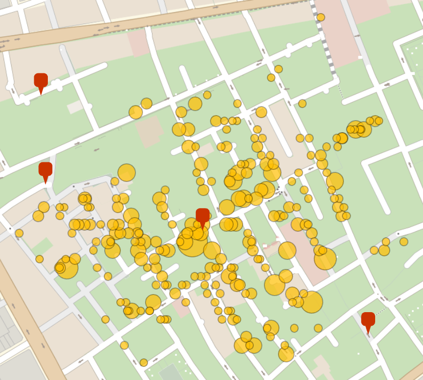
Considered the birth of epidemiology, the Jon Snow Cholera Map showed that London Cholera deaths were centered on a contaminated water pump. This data resource contains the death count at each location and the geo locations of the water pumps

(250 elements)

Examples

Basic Examples

In[1]:=
Short[ResourceData[\!\(\*
TagBox["\"\<John Snow Cholera Data\>\"",
#& ,
BoxID -> "ResourceTag-John Snow Cholera Data-Input",
AutoDelete->True]\), "Deaths"]]
Out[1]=

Visualizations (1) 

Show the locations of cholera related deaths and their proximity to water pumps:

In[2]:=
GeoBubbleChart[ResourceData[\!\(\*
TagBox["\"\<John Snow Cholera Data\>\"",
#& ,
BoxID -> "ResourceTag-John Snow Cholera Data-Input",
AutoDelete->True]\), "Deaths"], Epilog -> GeoMarker[ResourceData[\!\(\*
TagBox["\"\<John Snow Cholera Data\>\"",
#& ,
BoxID -> "ResourceTag-John Snow Cholera Data-Input",
AutoDelete->True]\), "WaterPumps"]]]
Out[2]=

Jon McLoone, "John Snow Cholera Data" from the Wolfram Data Repository (2022)  

Data Resource History

Source Metadata

Publisher Information