Wolfram Data Repository
Immediate Computable Access to Curated Contributed Data
Locations of springs and sinkholes in the Ozark Plateaus Physiographic Province (Ozarks) in Arkansas
Retrieve the data:
| In[1]:= |
| Out[1]= |  |
Summary of the spatial point data:
| In[2]:= |
| Out[2]= |  |
Plot the spatial point data:
| In[3]:= |
| Out[3]= | 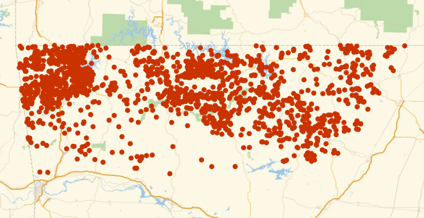 |
Visualize the data with annotations:
| In[4]:= | ![legend = PointLegend[{Black, Orange}, {"sinkhole", "spring"}];
Legended[PointValuePlot[ResourceData[\!\(\*
TagBox["\"\<Sample Data: Ozarks Karst\>\"",
#& ,
BoxID -> "ResourceTag-Sample Data: Ozarks Karst-Input",
AutoDelete->True]\), "Data"], PlotStyle -> {Black, Orange}], legend]](https://www.wolframcloud.com/obj/resourcesystem/images/b80/b8034aae-319e-4162-b193-90bde06eb12c/135f9e0040921f57.png) |
| Out[5]= | 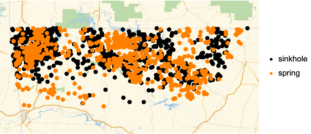 |
Compute probability of finding a point within given radius of an existing point - NearestNeighborG is the CDF of the nearest neighbor distribution:
| In[6]:= |
| Out[6]= |  |
| In[7]:= |
| Out[7]= |
| In[8]:= |
| In[9]:= |
| Out[9]= | 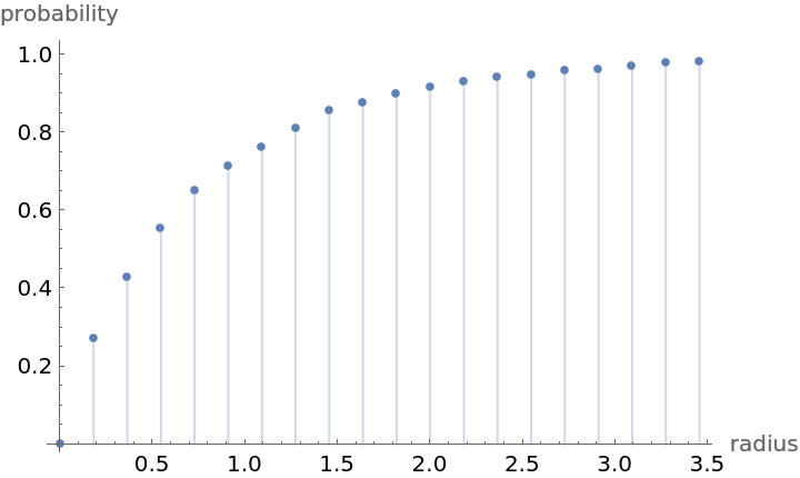 |
Mean distance between a typical point and its nearest neighbor (for positive support distribution can be approximated via a Riemann sum of 1-CDF):
| In[10]:= | ![step = maxR/100;
partition = Table[{k, k + step}, {k, 0, maxR, step}];
values = nnG[Mean /@ partition];](https://www.wolframcloud.com/obj/resourcesystem/images/b80/b8034aae-319e-4162-b193-90bde06eb12c/4ae753755f15f654.png) |
| In[11]:= |
| Out[11]= |
Test for complete spatial randomness:
| In[12]:= |
| Out[12]= |  |
Gosia Konwerska, "Sample Data: Ozarks Karst" from the Wolfram Data Repository (2021)